Cown Edge from Broadbottom
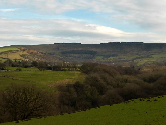
Cown Edge
It must say something about my sense of humour, or perhaps my medical condition, but any name including a “Bottom” always gets a personal snigger. It’s also one of my favourite cinematic moments; https://youtu.be/hBJ_FDcCwTU
Anyway, we were driving to Buxton this week and the satnav took us away from the standing traffic on the always congested Mottram-Hollingworth stretch of road. We were taken over the tops to Hayfield via Broadbottom and Charlesworth. The villages we drove through looked pleasant and interesting, so I returned on saturday for a walk. This is on the edge of the Dark Peak in the Peak District, and on the OL1 map. I made Cown Edge the objective setting off from the small free car park on Mill brow.

Coombes Rocks
From the friendly village centre, where I was stopped three times by admirers of Luna and her Ruffwear jacket, the route headed over the River Etherow. Following the Transpennine Trail through old Besthill Quarry took us to Glossop Road and around the back of Glossop Rugby Club. Tarmac lanes headed up towards Coombes Edge and around the rocks to Cown Edge. Here the path is the Cown Edge Way. It took us across the plateau between the edge and Coombes Rocks before crossing a moor to meet the Pennine Bridleway.

Robin Hoods Picking Stones
I stopped for a sandwich at Robin Hoods Picking Rods, two stone poles beside the track. This ancient and strange structure is described as probably once part of a 9th century Anglo-Saxon/Mercian cross. It is thought that originally there was only one column here, now broken in two and then set as two short columns. It also forms the current boundary between Derbyshire and Cheshire/Greater Manchester. The stones are also referred to as Robin Hood’s Stumps, and even the Druid Stones. According to the Legend, Robin Hood used the column or columns ‘to bend his bow on’ and so the name has stuck. Having recently finished Bernard Cornwell’s novels on Crecy and Agincourt, this theory does not make a lot of historical sense!
Cown Edge Way headed off down to Marple, but I followed country lanes back down to the River Etherow through old and hamlets at Hilltop and High Chisworth.

Bleaklow and Longdendale from Owd House Far Wildseats Farm.

Broadbottom with Tintwistle Moors behind
Back on the Cown Way as it approached Broadbottom a sturdy footbridge crossed the river to take us back into the town. Alongside the river were more old cottages beside the old packhorse route taking salt from Cheshire into Yorkshire. These were mainly weavers three-storied buildings. Below the town were also the remains of more recent Broadbottom industry at Hodge printing vats, remains of old bleaching and dyeing works, and around to the remains of Broad Mill and the well-kept workers terraces of houses that separated the mill from the road.

17th Century Cottages at Hodge Fold.

Dyeing Vats at Hodge Fold
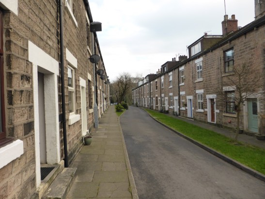
New Street Broadbottom
http://www.shareyouradventure.com/map/perma/70388/iframe
Full details of the walk are at http://www.walkingbritain.co.uk
Length 11.9 km Ascent – 326 metres. Start – OS grid reference SJ994937
Postcode SK14 6AL (approx. location only)

Sounds like a great walk Tony …. Worrying video clip though!? ….. And we all know Robin was in Sherwood Forest most of his time …. Knew he travelled a bit …. But Chesire …. Surely not …. Take it easy!?,