Derwent Edge on Rememberance Sunday and Kinder Downfall recovery from the party.

Derwent Edges across Ladybower Reservoir, evening view
Dick pulled the curtain back, opened the window wide (he does like the fresh air) and there it was, a clear blue sky. Our room in Edale Hostel looked back up to the fell and from the breakfast room we looked out over the cloud inversion below us in Edale. Sunday promised to be a good one, whereas Saturday gave us the rain and grey skies a Peak District November often brings.
Our group of walking friends made this weekend our Autumn walking trip as it fell nicely after Mikes 50th Birthday party on Friday over in Manchester. Just the one family crisis this time giving us a good turnout of eight. Friday’s weather was despicable for the drive up from the south and the forecast for Saturday didn’t promise much better, heavy rain all day.

Setting off in the rain from Bowden Bridge.
Despite the forecast, we stuck with the itinerary and set off from Bowden Bridge at Hayfield, after a short briefing on The Trespass. As we got into Williams Clough the rain and wind picked up to quite a downpour. Comparing the effectiveness of our waterproofs gave some of us the chance to express our opinions on Pro Gortex, Paramo or the best that Trespass could offer. Steve took the chance to test his new Yeti Gaiters, a bit over the top for bog trotting but considerably more waterproof than his boots.

Steve testing out his new Yeti gaiters. They did leak a bit, not tight enough he explained.
The gales got up as we did the final climb onto the Kinder edge so we took the opportunity of stopping for a mix and match lunch in the small gully around Sandy Heys. Kinder downfall had a lot of water going over it, but despite the strong southwesterly, the waterfall wasn’t doing its famous reverse fall. Beyond the downfall it stopped raining, the wind dropped and the cloud lifted slightly, so we could see across to Manchester. An airport runway was clear in the distance, but on checking it appeared to be Woodford rather than Ringway International Airport..

Crossing the River Kinder above the Downfall. Bill in the hi-vis jacket is taking it carefully.
Soon we were dropping down past Kinderlow and Edale Rocks and the gentle walk down towards Hayfield. The group took a general dislike to the path surface, generally rubble making it difficult to walk on, particularly for soft feet not used to the longer day.

Kinder Downfall on a wet day.
A tame heron stopped on a wall to watch us as we approached the car park, it was a common sight on this river according to a friendly local lady who was passing. We didn’t manage to get past The Sportsman before leaving Hayfield and so enjoyed a refreshing drink.

The Eight of Us on Lost Lad, above Derwent Reservoir. Yes there are only eight of us, Mike and I managed to get in twice. L-R Adrian, me, Mike, Bill, Dick, Rob, Nas, Tony (again), Steve (after handing iphone to Adrian), Mike (again).
Lovely morning for a walk along the path alongside Derwent Resr. The earlier cloud and mist are lifting.
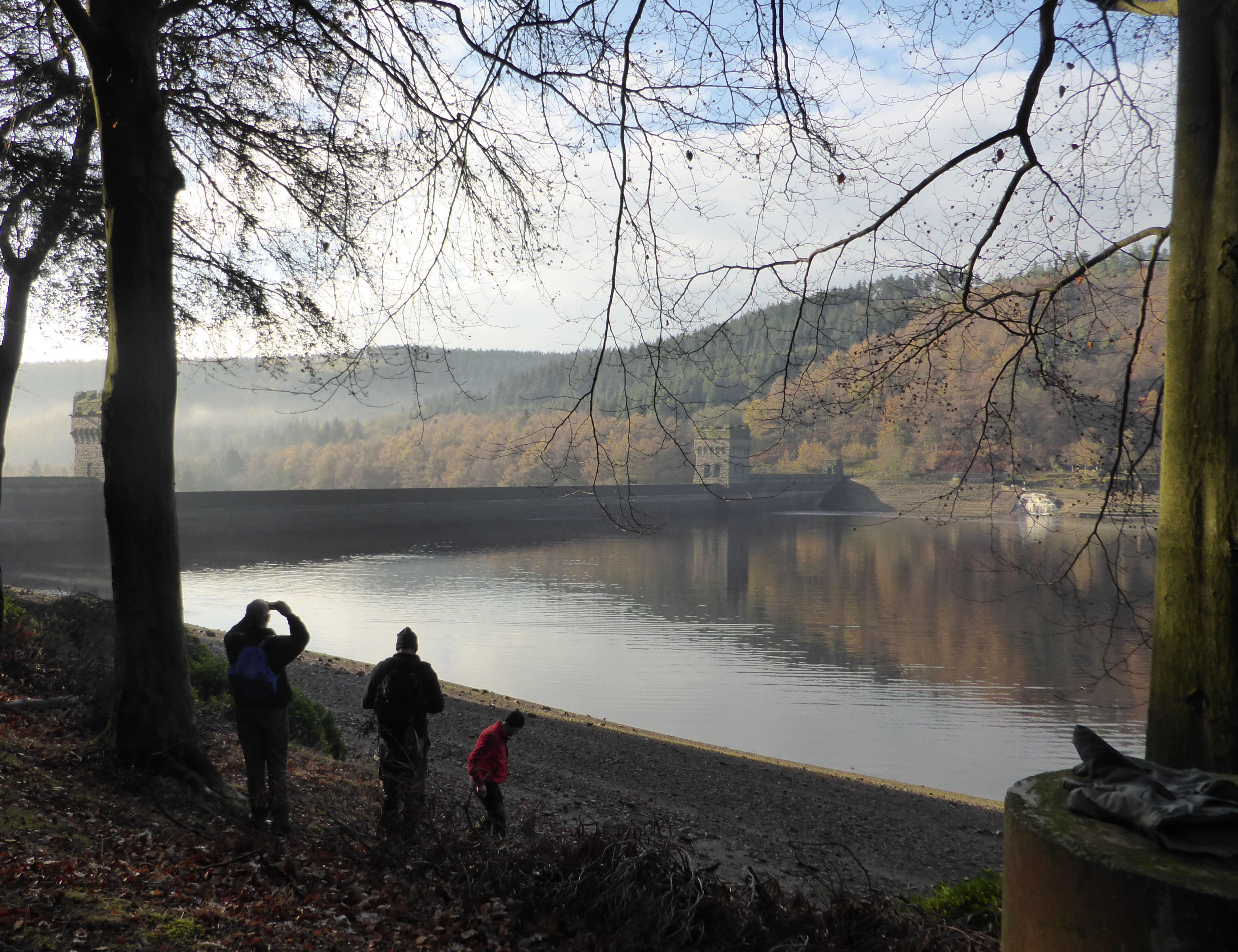
Next morning was bright as promised and we met up at Fairhomes on Ladybower Reservoir. Mike just made it to join us, missing out on the excellent brew from the cafe there. The mist cleared as we set off alongside Derwent Reservoir east bank, so we had a delightful views of the dam and its famous towers. The water levels were way down, the lowest I have seen, so no cascade over the top of damn this time. Our path up to Derwent edge started with a smart PNFS sign pointing up Abbey Bank. This was a lovely track taking us first through the woods then up to the moors with fabulous views all around. As it was approaching 11:00 on Remembrance Sunday we stopped and lined up to observe a minutes silence, ending with a blast from Bills whistle. Our view up over Howden was down the approach route for the Lancaster Bombers practising the Dambusters raid over 70 years ago. Later a small Cessna buzzed down the valley close to the water, no doubt taking excited visitors on a recreation of the daring run the Lancasters took.
Bill always gives a good story. Shame I can’t remember what this one was!
It was time to break open the cake tin when we arrived at Lost Lad viewpoint. Rachel’s tasty chocolate cake was dutifully shared out, and there was enough for a second helping. Great, enough to keep us going until lunch. Lots of fun was had playing with the panorama app on Steve’s iphone and we tried to get into the picture twice. This worked much better than yesterdays attempt on Kinder Downfall.

Posing for the groupie after the Chocolate Cake
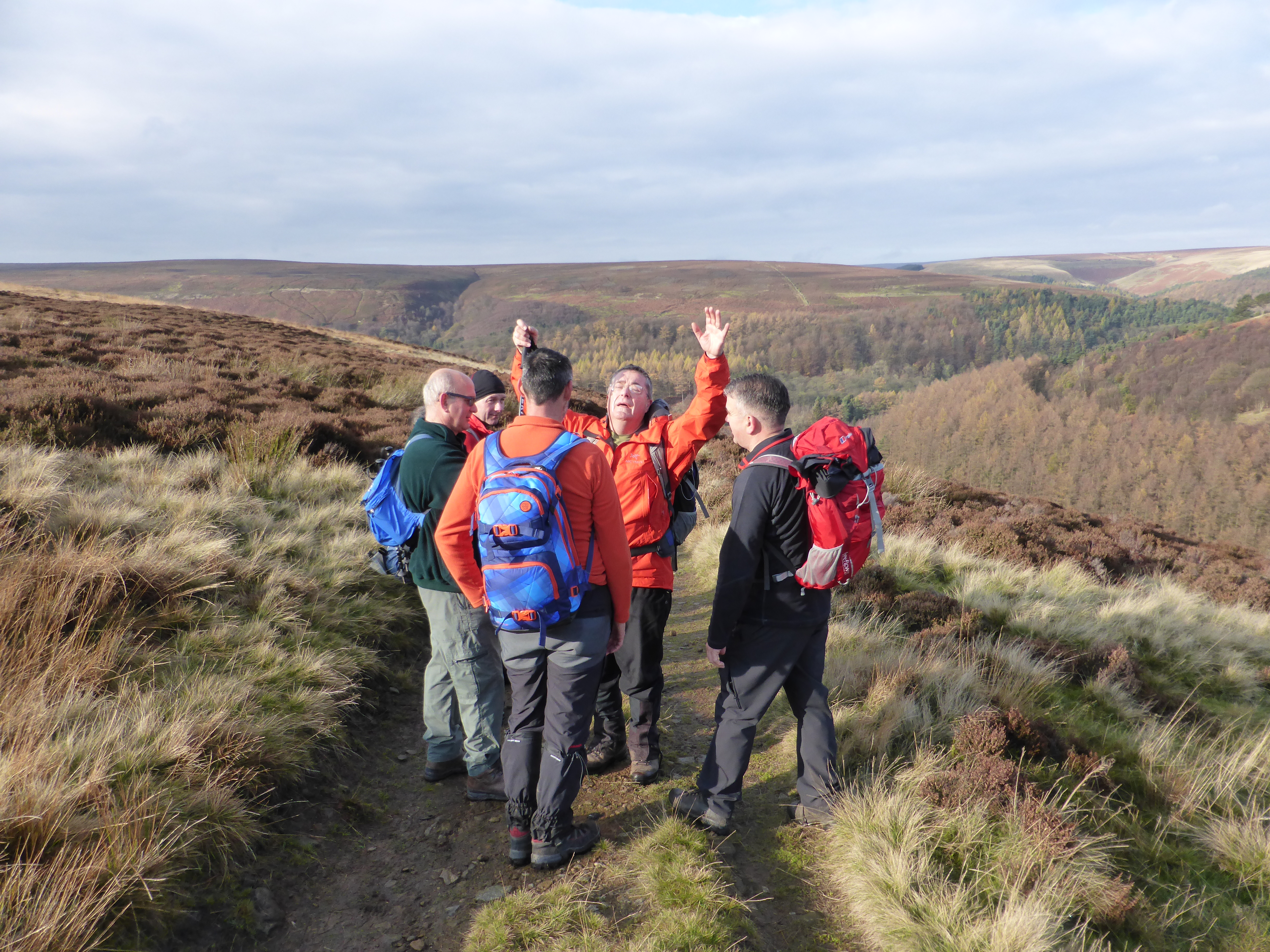
Up to Back Tor and along the ridge, it was a busy day up there, with clear views west across to Kinder, Mam Tor and the Great Ridge and Bleaklow. The best of the Dark Peak lay out before us.
Lunch consisted mainly of Friday left overs plus Mikes fresh chicken legs (I’m sure there’s a joke there, but will have to leave the reader to work it out). It was a great stroll for us along the edge, and a tame grouse followed us, posing for a few few photo’s. This was a first spotting of a grouse for some of us, and reminded Bill that he had a hip flask to share.
Close to the large JCB diggers rebuilding the path, (how did they get up there and was the path in such a bad way it needs such surgery?) we took the way back down into the valley. There were lots of mountain bikers struggling up this track, a bit of a shame as by my reckoning it should be done as a downhill. The official guide confirmed this.

Dropping down to Ladybower.
A final stroll along the reservoir edge and after stopping to look over the remains of Derwent village we arrived back at the car park just before the requested time. Most of the lads had to drive down to the south and wanted to get back in time for a late Sunday dinner.

The Bleak side of the Peak District, looking north from Back Tor

